
HY-2B
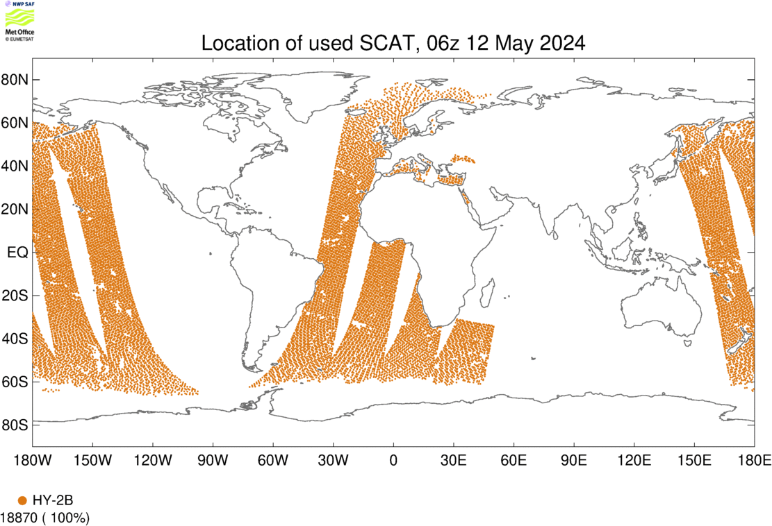
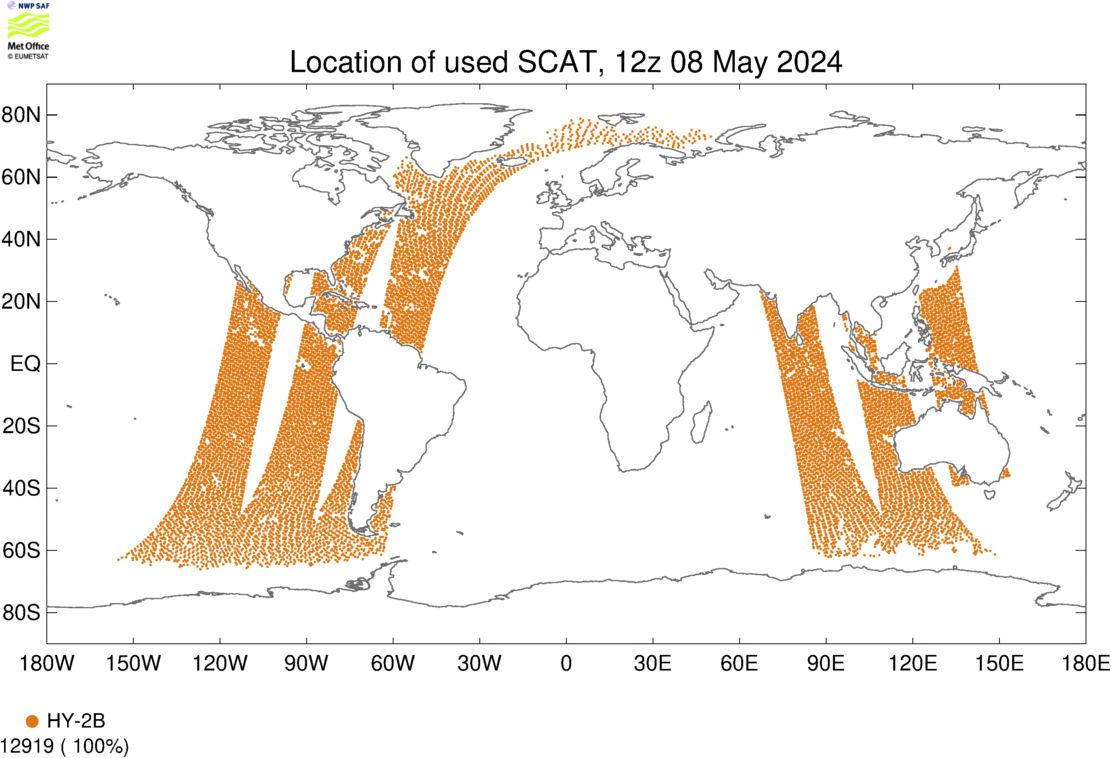
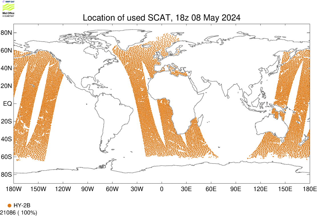
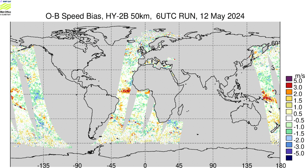
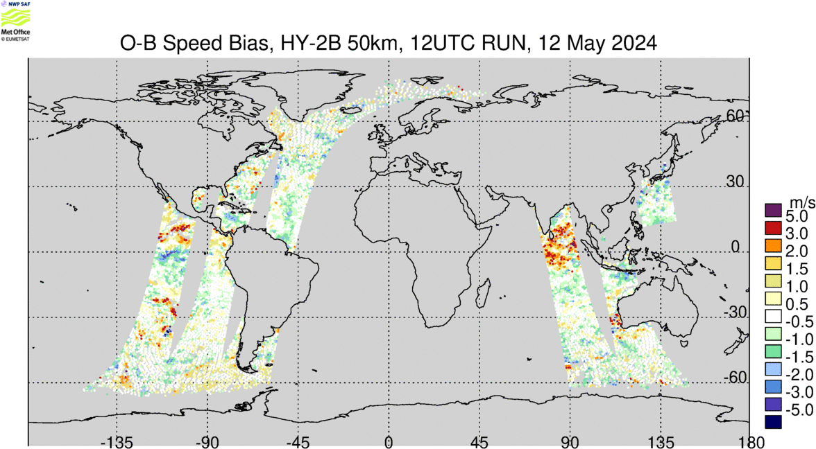
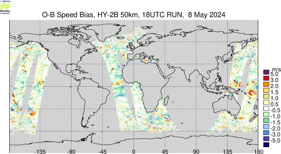
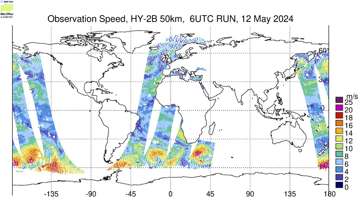
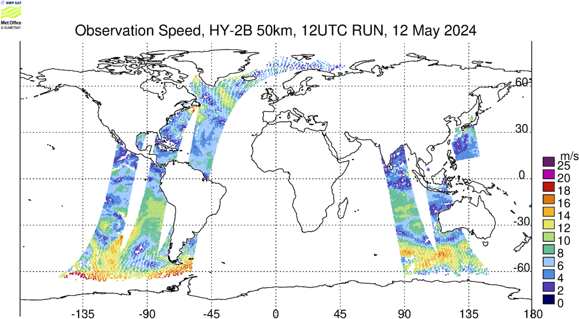
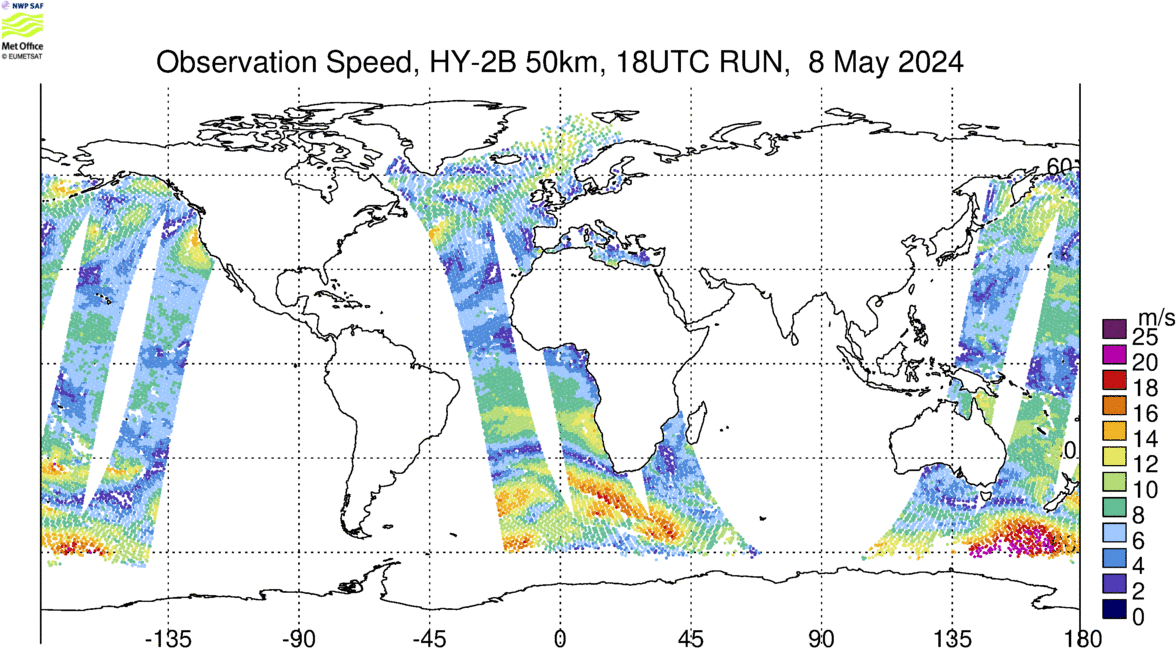
HY-2B is a marine remote sensing satellite launched by the Chinese National Satellite Ocean Application Service (NSOAS) on 24 October 2018. The HY-2B scatterometer (HSCAT) is a rotating pencil beam scatterometer operating in Ku-band at 13.25 GHz which traces out a ~1300 km swath. The EUMETSAT Ocean and Sea Ice Satellite Application Facility (OSI SAF) have developed a HY-2B wind product which makes use of the level 1b backscatter data made available by NSOAS.
HY-2B is under going pre-operational testing at the Met Office.
Acknowledgements and status
Level 1b: NSOAS
Level 2b: OSI SAF (in development status)
Latest Data (updated every 6 hours)
00 UTC |
06 UTC |
12 UTC |
18 UTC |
|
| Data Coverage | 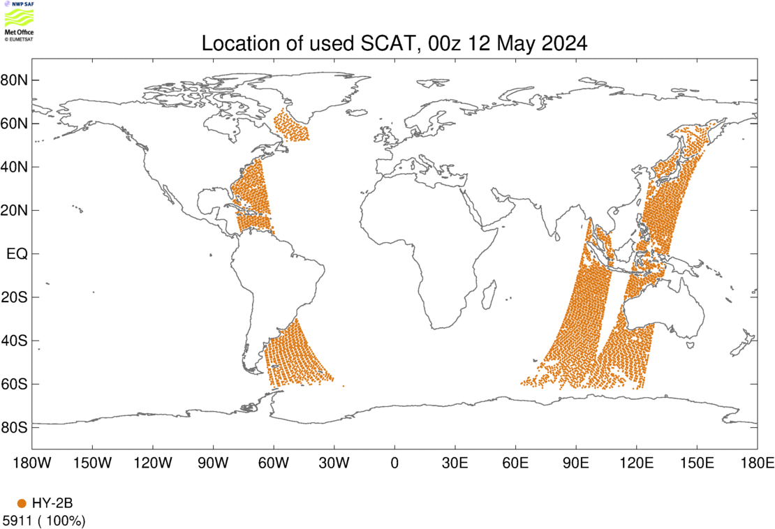 |
 |
 |
 |
| Map O-B Speed Bias | 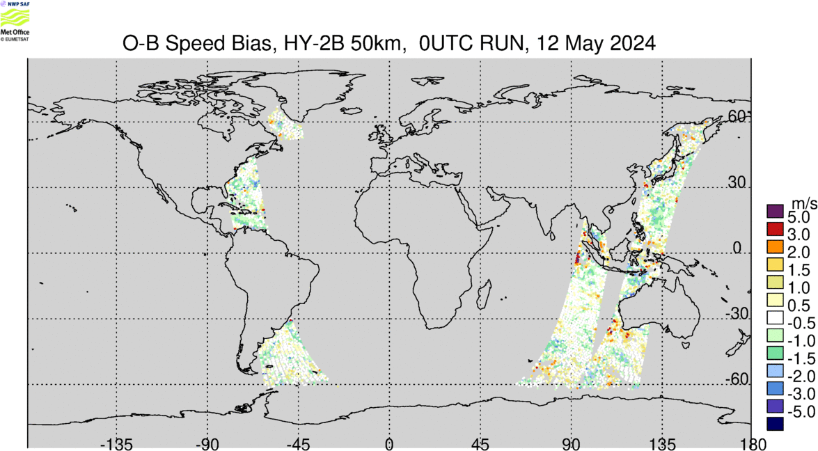 |
 |
 |
 |
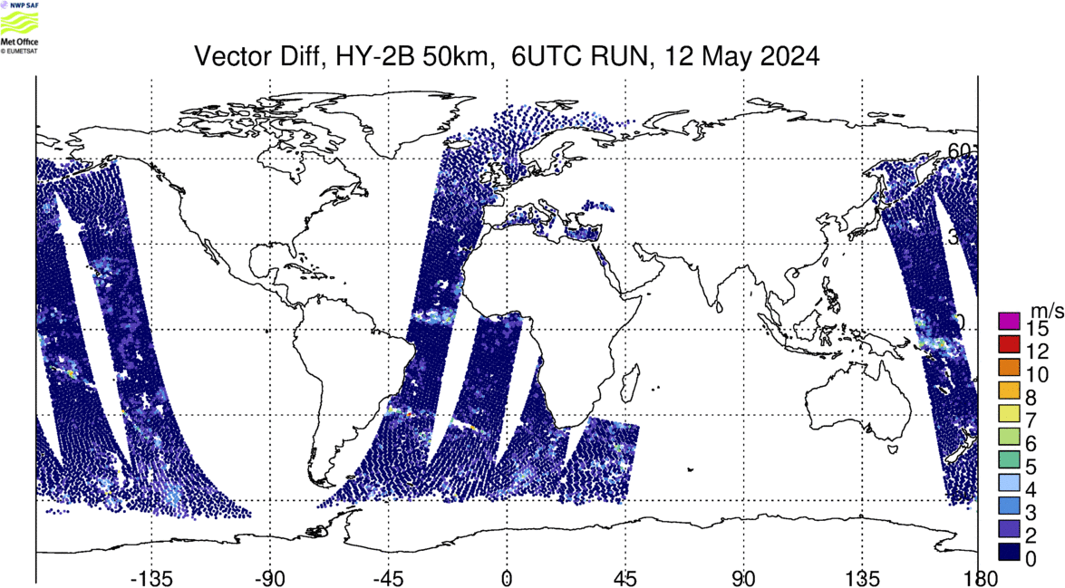
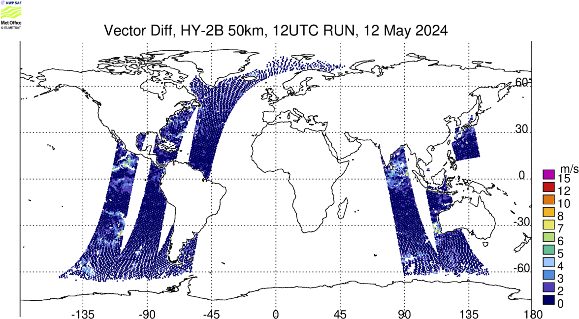
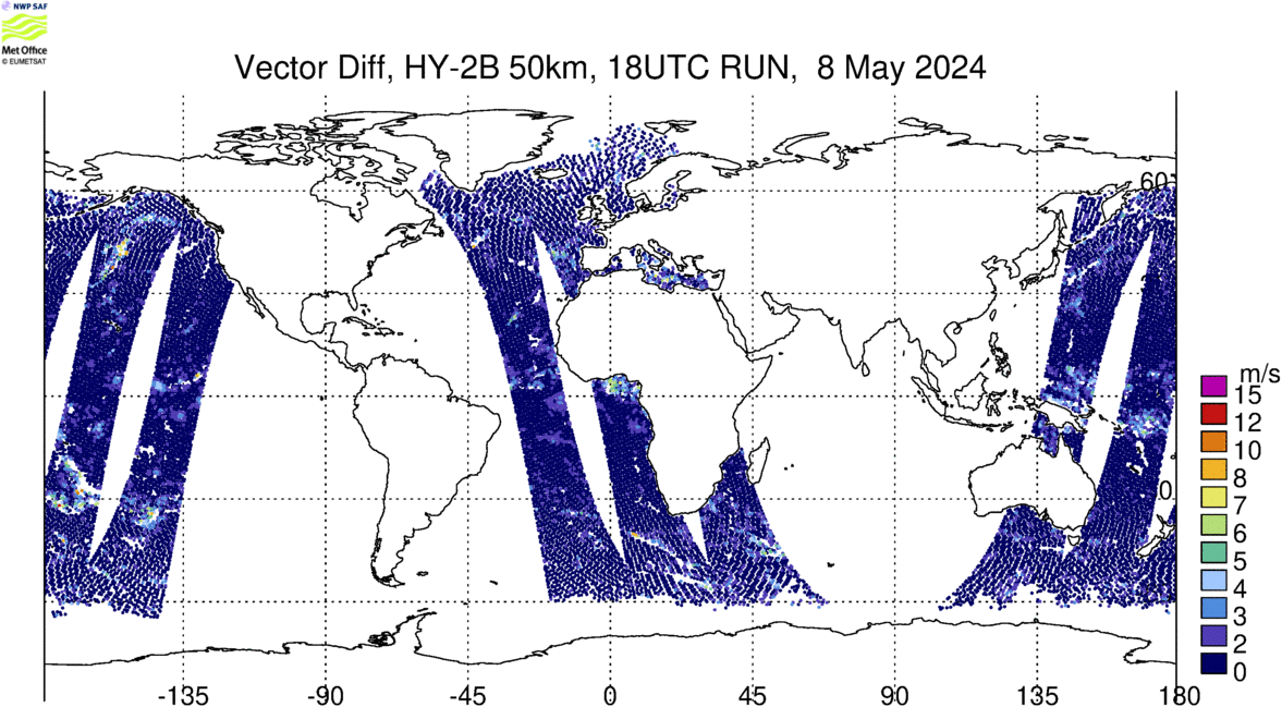
| Map O-B Vector Difference | 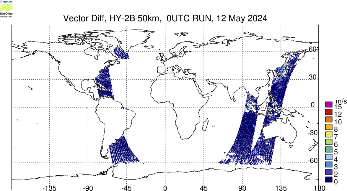 |
 |
 |
 |
| Map Observed Speed | 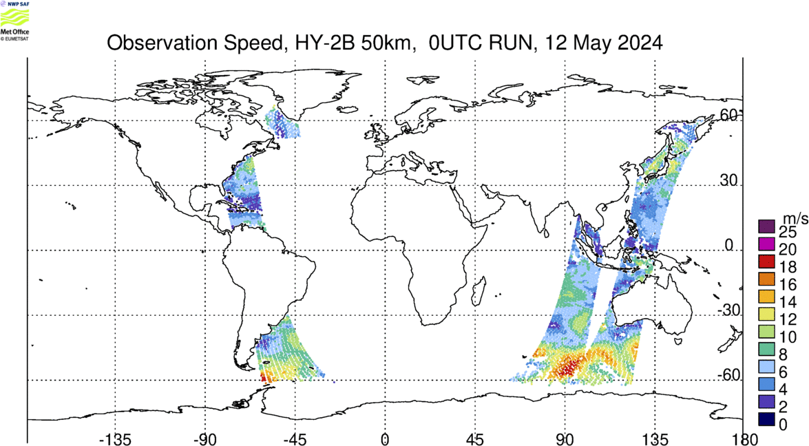 |
 |
 |
 |
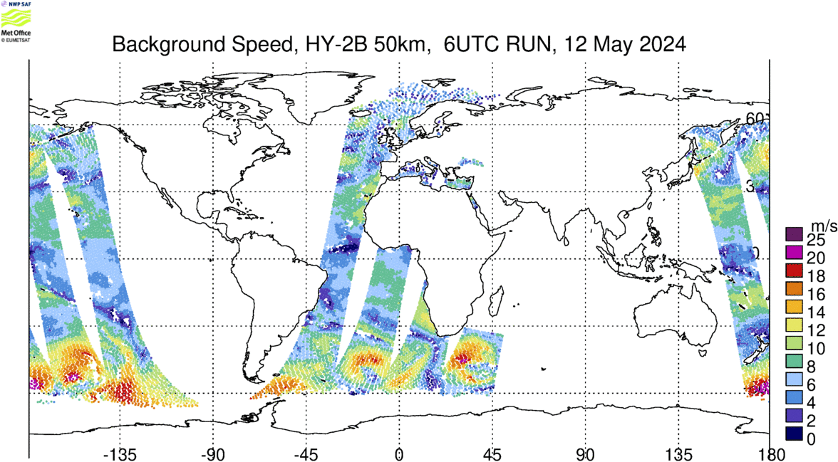
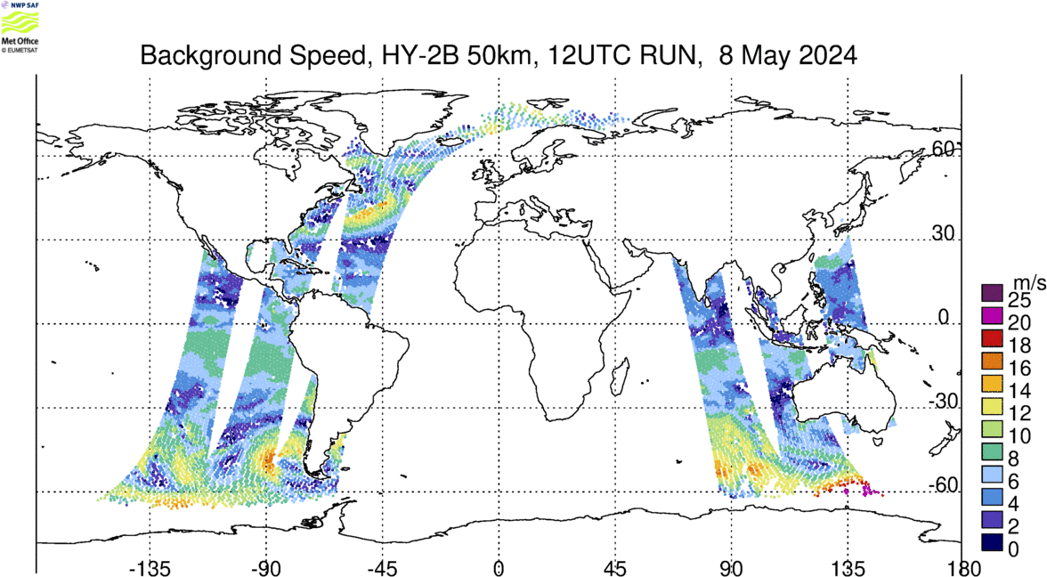
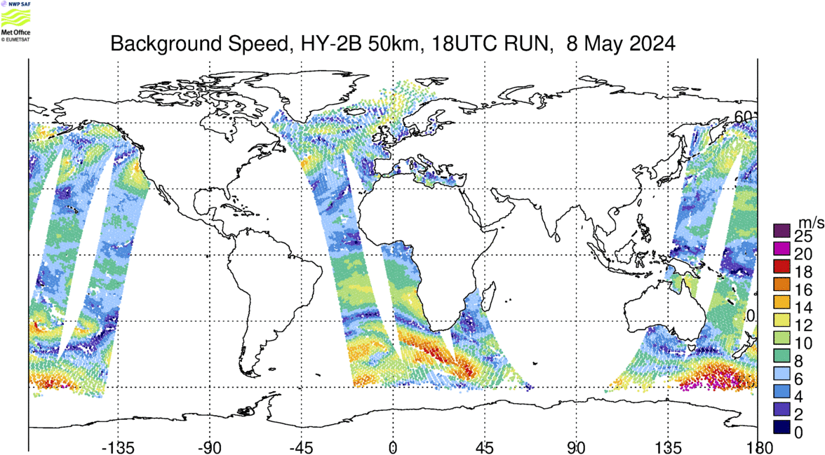
| Map Background Speed |  |
 |
 |
 |
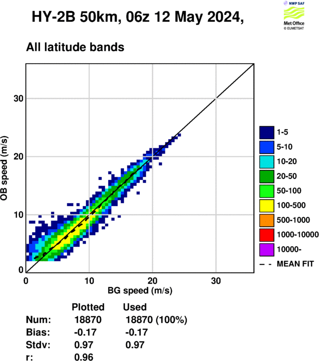
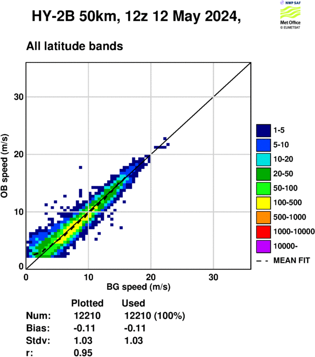
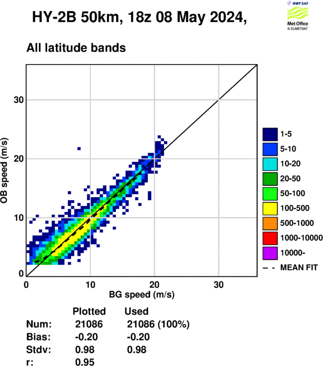
| Speed 2D Histogram | 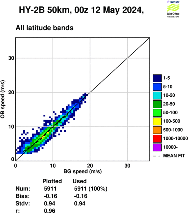 |
 |
 |
 |
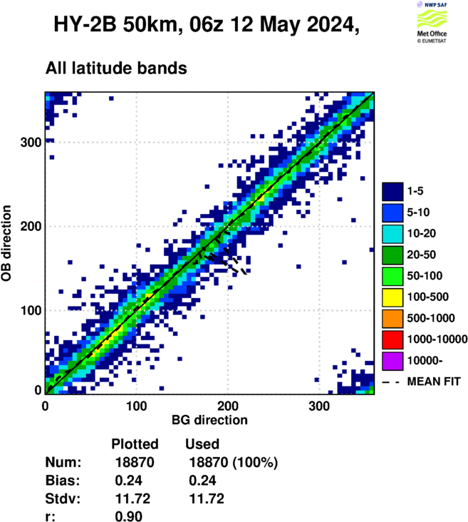
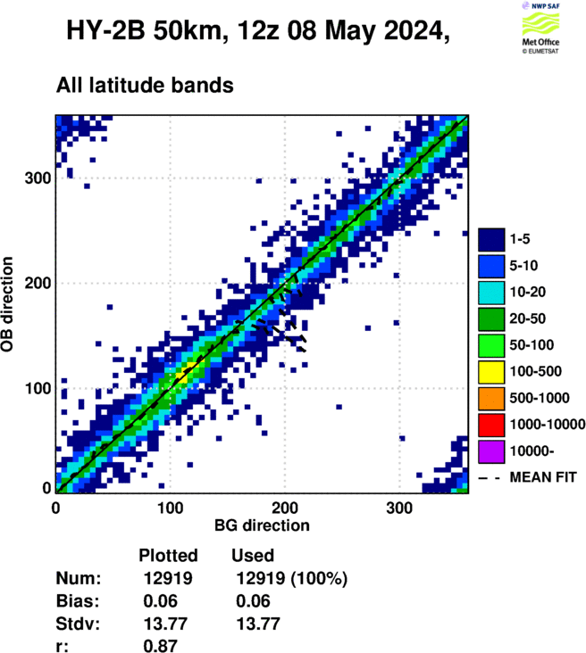
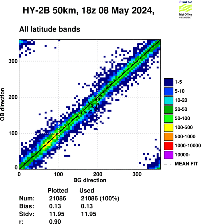
| Direction 2D Histogram | 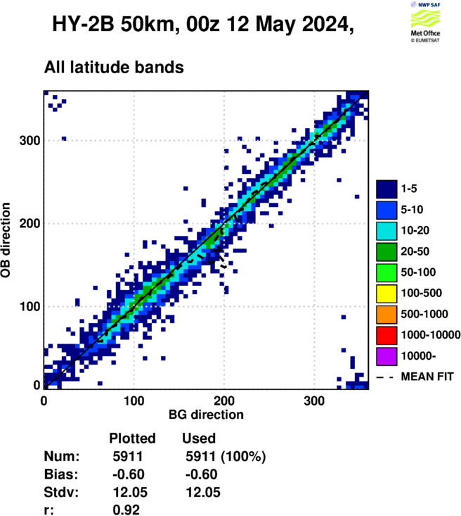 |
 |
 |
 |
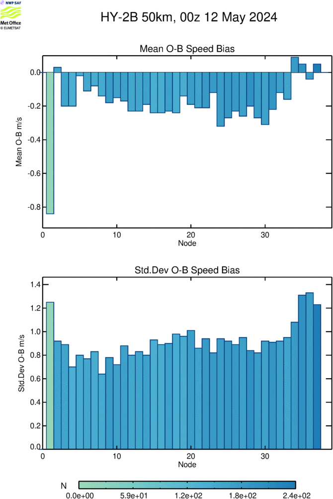
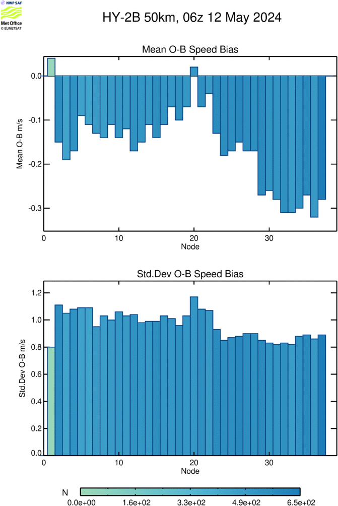
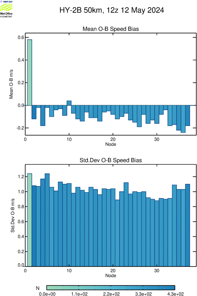
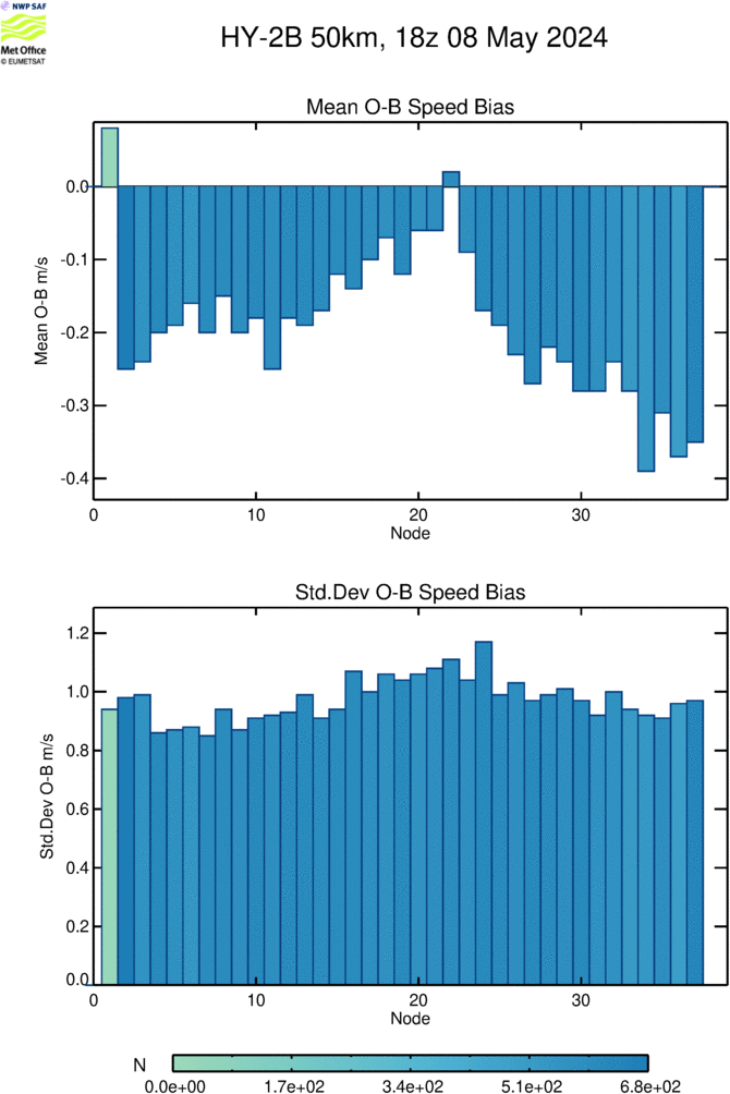
| O-B Speed Bias By Crosstrack Cell |
 |
 |
 |
 |
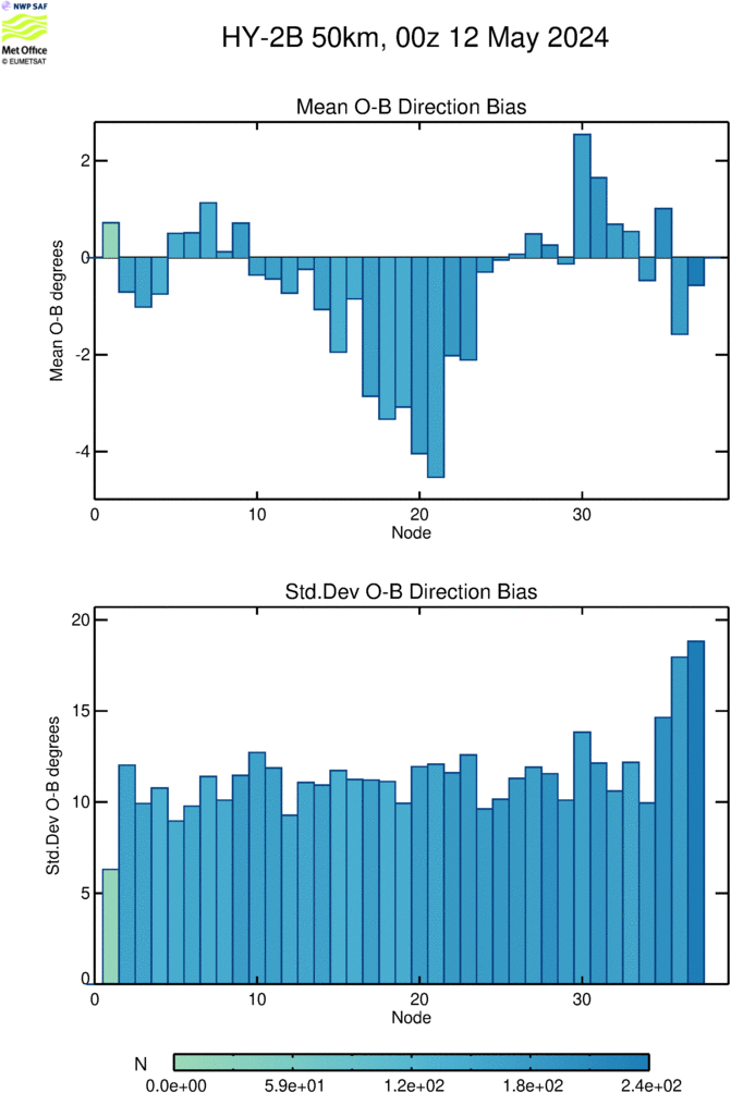
| O-B Direction Bias By Crosstrack Cell |
 |
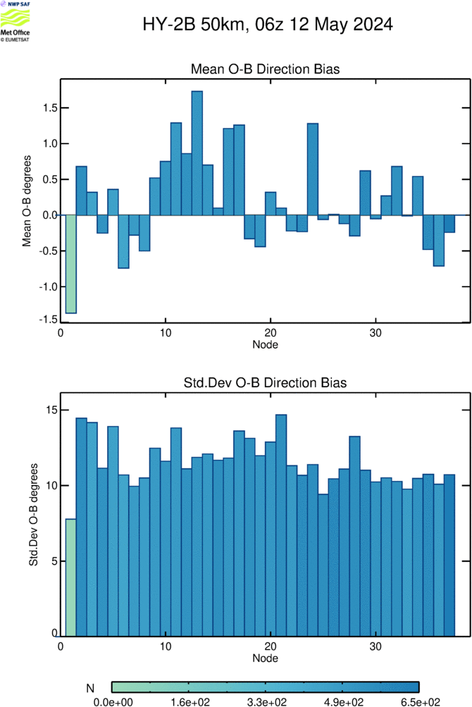 |
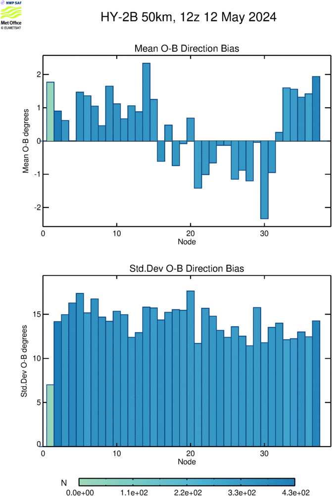 |
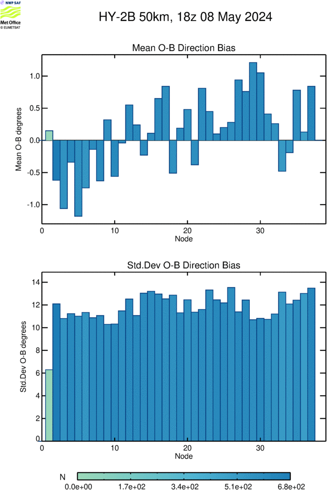 |
Last 30 days (updated once per day)
| Time Series I | 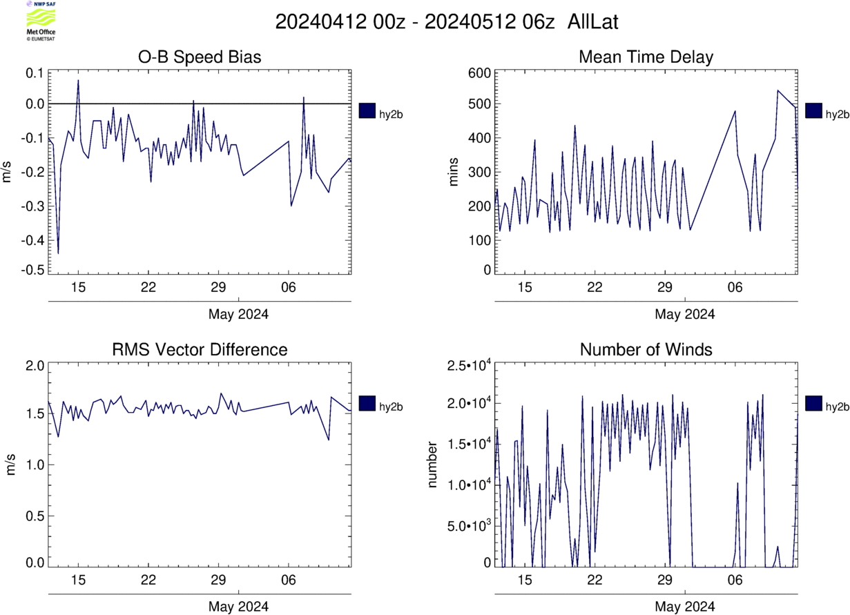 |
| Time Series II | 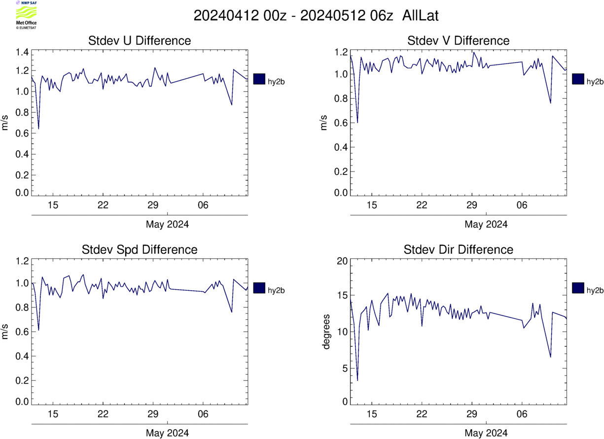 |