Data Availability and Timeliness Monitoring
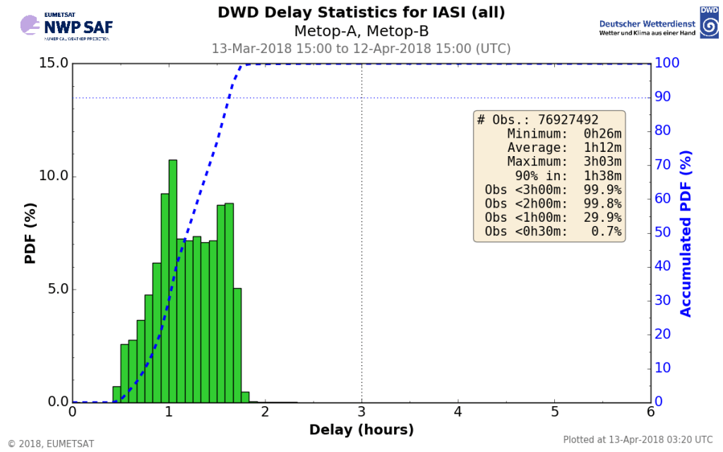
The near-real time satellite data monitoring of the NWP SAF has recently been extended by a new component, the near-real time data availability monitoring (accessible via the NWP SAF web site under “Monitoring – NRT availability”). It provides the data coverage as well as timeliness information for data from all satellite instruments commonly used at operational NWP centres – and thus complements the well established and extensive NRT data quality monitoring provided by the NWP SAF.
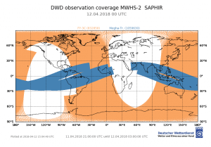
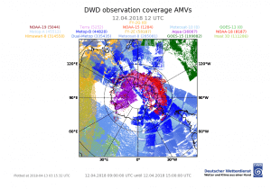
Fig. 2: Examples of data coverage plots, here for 12 April 2018. Left: MHWS-2/FY-3C and SAPHIR/Mega-Tropiques data around 00 UTC (21 UTC – 03 UTC); right: AMVs coverage for the southern polar cap around 12 UTC (9:00 – 15:00; polarstereographic projection).
The service monitors commonly used satellite data from sounders and imagers as well as wind data from scatterometers, altimeters and atmospheric motion vectors (AMVs) from geostationary and polar orbiting satellites provided by various satellite agencies.
The aim of this availability monitoring is to provide up-to-date information on the geographical coverage of main data sources as well as the time delay between the observation time and data reception at NWP centres. This allows users to see at a glance which data may be available for their applications while also meeting their operational timeliness requirements. Data which are not only available via the transmission of the global data downlink but also via the faster regional reception network distribution (DBNet service) are monitored separately and both results are made available.
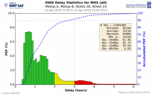
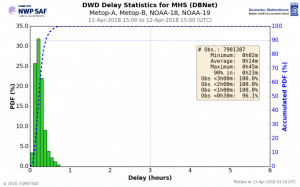
Fig. 3: Example of timeliness statistics for MHS data from METOP and NOAA satellites (24h statistics for 11-12 April 2018) for both global (left, data from global data downlink including all NOAA and METOP satellites) and DBNet data reception (right).
A second aim of this new monitoring is to support the detection of potential data reception issues. For this purpose, the timeliness information is provided for the last 24h as well as averaged over the last month to allow comparisons of the current situation compared to normal reception conditions. This is complemented by time series of the number of data received as a function of time for the last month as well as time series of the number of data received within certain delay thresholds. These allow to judge the stability of data reception and timeliness and to detect data transmission issues. Together with the current data coverage plots the diagnostics provide comprehensive information about normal and current data reception and timeliness. All information is updated every 6h.
The data availability monitoring results are provided from more than one centre, with DWD and the MetOffice using the same layout for coverage and timeliness plots to allow comparisons and to enable tracking causes for differences in data reception speed or possible data outages. Information on the used data reception routes will also be included.
The near-real time availability monitoring service will evolve further with new data types being added as well as complementary ways to analyze and display the information.
This monitoring is one of the contributions of the DWD (German Weather Service) which has joined the NWP SAF in March 2017 at the start of the third Continuous Development and Operations Phase (CDOP-3). Other areas of activity of DWD in the NWP SAF include the provision of a fast radiative transfer method for visible radiation in the presence of clouds for the RTTOV software (MFASIS, included for RTTOV 12.2), as well as a monitoring of atmospheric motion vector heights in comparison to Lidar cloud top height and other diagnostic contributions like the monitoring of reconstructed radiances for IASI and quality evaluation of selected new satellite instruments.
