
Assimilation of Hyper-spectral Geostationary Satellite Observations workshop
ECMWF recently hosted the EUMETSAT NWP-SAF international workshop on the ‘Assimilation of Hyper-spectral Geostationary Satellite Observations’ from 22 to 25 May 2017. Forty one experts from Europe, China, Korea, Japan and the US gathered to assess the potential benefits of these exciting new instruments as well as the technical issues that will need to be addressed to maximise their potential for numerical weather prediction (NWP).
“The workshop was convened to assess our state of readiness and plot a roadmap for research and development to ensure that these unique observations will be exploited to their full potential,” ECMWF scientist Tony McNally said.
“Presentations showed how these data will provide new and highly detailed information on atmospheric wind, temperature and humidity. In particular, the high temporal sampling will allow us to observe rapid evolutions in the atmosphere and improve the forecasting of severe weather events.”
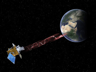
The new instruments will be carried by geostationary satellites, such as EUMETSAT’s Meteosat Third Generation (MTG) satellites to be deployed from 2021. They include the ‘hyperspectral’ Infrared Sounder (IRS), which will for the first time provide a continuous stream of detailed vertical information on wind, temperature and humidity. The IRS obtains this information by measuring thermal radiation emitted from the atmosphere at very high spectral resolution. Polar-orbiting satellites already carry hyperspectral instruments (e.g. IASI and CrIS). However, since they circle the globe in a sun synchronous low Earth orbit, they may observe any particular area of the globe twice a day. Geostationary satellites, are located high above the equator and continuously observe the large circular region of the Earth below.
“Areas where our satellite data processing and assimilation systems will have to be significantly improved to use these data have also been identified at the workshop,” Dr McNally said.
The working groups made clear recommendations on how this can best be achieved.
“One key conclusion was that the community should make every effort to access and study data from the Chinese satellite FY-4A, which carries a prototype hyperspectral instrument.
“There was also broad agreement that the MTG-IRS is such a technologically challenging instrument to build and indeed use that very close cooperation between EUMETSAT and the NWP community is needed throughout the development phase and, critically, in the post-launch calibration period.”